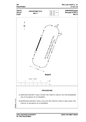
VAC chart of RPLC
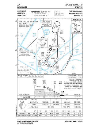
 IAC chart of RPLC
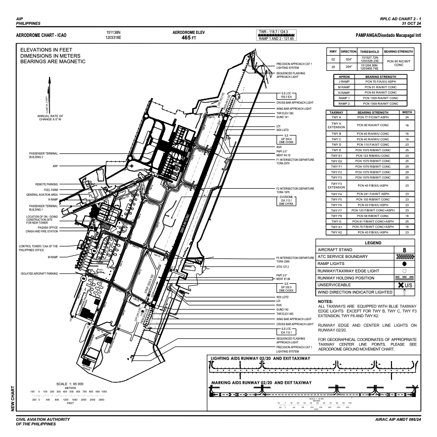
 ADC chart of RPLC
 Satellite view of RPLC
IAC chart of RPLCADC chart of RPLC
Satellite view of RPLC
Sorry, we have no imagery here.
Sorry, we have no imagery here.
Sorry, we have no imagery here.
Sorry, we have no imagery here.
Sorry, we have no imagery here.
Sorry, we have no imagery here.


RPLC - Diosdado Macapagal International Airport
Located in Angeles City, Philippines
ICAO - RPLC, IATA - CRK
Data provided by AirmateGeneral information
Coordinates: N15°11'38" E120°33'18"
Elevation is 465 feet MSL.
Magnetic variation is -3° East View others Airports in Pampanga
Operational data
Special qualification required
Current time UTC:
Current local time:
Weather
METAR: RPLC 181600Z 27002KT 9999 FEW020 SCT100 29/23 Q1012 NOSIG RMK A2988
TAF: TAF RPLC 181100Z 1812/1918 32005KT 9999 FEW020 TX35/1906Z TN26/1821Z TEMPO 1812/1818 04008KT SCT020 BKN100
Communications frequencies: [VIEW]
Runways:
| RWY identifier | QFU | Length (ft) | Width (ft) | Surface | LDA (ft) |
| 02 | 21° | 10499 | 197 | CONC | 10499 |
| 20 | 201° | 10499 | 197 | CONC | 10499 |
Airport contact information
Address: Angeles City Philippines
Satellite view of RPLC
Sorry, we have no imagery here.
Sorry, we have no imagery here.
Sorry, we have no imagery here.
Sorry, we have no imagery here.
Sorry, we have no imagery here.
Sorry, we have no imagery here.