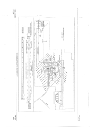
VAC chart of OSDI
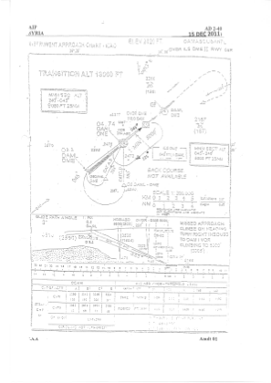
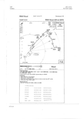 IAC chart of OSDI
 ADC chart of OSDI
 Satellite view of OSDI
IAC chart of OSDIADC chart of OSDI
Satellite view of OSDI
Sorry, we have no imagery here.
Sorry, we have no imagery here.
Sorry, we have no imagery here.
Sorry, we have no imagery here.
Sorry, we have no imagery here.
Sorry, we have no imagery here.


OSDI - Damascus / International
Located in Damascus, Syrian Arab Republic
ICAO - OSDI, IATA - DAM
Data provided by AirmateGeneral information
Coordinates: N33°24'39" E36°30'48"
Elevation is 2020 feet MSL.
View others Airports in Damascus Governorate
Operational data
Special qualification required
Current time UTC:
Current local time:
Weather
METAR: OSDI 170400Z 02005KT CAVOK 17/M01 Q1018
TAF: OSDI 162300Z 1700/1806 03006KT CAVOK TEMPO 1712/1718 22015KT
Communications frequencies: [VIEW]
Runways:
| RWY identifier | QFU | Length (ft) | Width (ft) | Surface | LDA (ft) |
| 05R | 48° | 11811 | 148 | ASP | |
| 23L | 228° | 11811 | 148 | ASP | |
| 05L | 48° | 11811 | 148 | ASP | |
| 23R | 228° | 11811 | 148 | ASP |
Airport contact information
Address: Damascus Syrian Arab Republic
Satellite view of OSDI
Sorry, we have no imagery here.
Sorry, we have no imagery here.
Sorry, we have no imagery here.
Sorry, we have no imagery here.
Sorry, we have no imagery here.
Sorry, we have no imagery here.