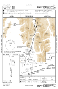
IAC chart of KMYL
 ADC chart of KMYL
 Satellite view of KMYL
ADC chart of KMYL
Satellite view of KMYL
Sorry, we have no imagery here.
Sorry, we have no imagery here.
Sorry, we have no imagery here.
Sorry, we have no imagery here.
Sorry, we have no imagery here.
Sorry, we have no imagery here.


KMYL - Mc Call Muni
Located in Mc Call, United States
ICAO - MYL, IATA - MYL
Data provided by AirmateGeneral information
Coordinates: N44°53'19" W116°6'6"
Elevation is 5024 feet MSL.
Magnetic variation is 13° East View others Airports in Idaho
Operational data
Special qualification required
Current time UTC:
Current local time:
Weather
METAR: KMYL 030551Z AUTO 34005KT 10SM CLR 08/01 A2996 RMK AO2 SLP120 T00780011 10206 20078 50001 $
TAF: KMYL 030527Z 0306/0406 VRB06KT P6SM FEW200 FM040000 30008KT P6SM BKN070 PROB30 0400/0406 33010G20KT -TSRA OVC035CB
Communications frequencies: [VIEW]
Runways:
| RWY identifier | QFU | Length (ft) | Width (ft) | Surface | LDA (ft) |
| 16 | 179° | 6101 | 75 | ASPH | |
| 34 | 359° | 6101 | 75 | ASPH |
Airport contact information
Address: Mc Call United States
Other aviation service providers
Flight schools

Mccall Mountain Canyon Flying Seminars, Llc.
Mccall Mountain Canyon Flying Seminars, Llc.
admin@mountaincanyonflying.com+1(208)634-1344
Satellite view of KMYL
Sorry, we have no imagery here.
Sorry, we have no imagery here.
Sorry, we have no imagery here.
Sorry, we have no imagery here.
Sorry, we have no imagery here.
Sorry, we have no imagery here.