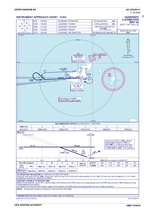
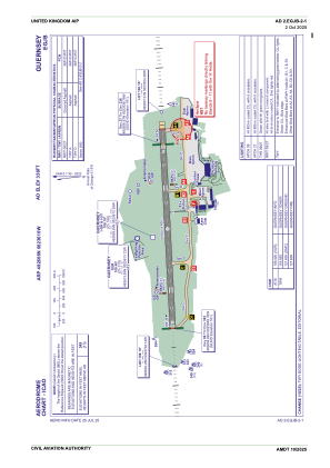
EGJB - Guernsey
Located in St Peter Port,
ICAO - EGJB, IATA - GCI
Data provided by AirmateGeneral information
Coordinates: N49°26'6" W2°36'10"
Elevation is 336 feet MSL.
Magnetic variation is 0° East View others Airports in (unassigned)
Operational data
Special qualification required
Current time UTC:
Current local time:
Weather
METAR: EGJB 061020Z 06014KT CAVOK 12/06 Q1019
TAF: TAF EGJB 060758Z 0609/0618 07014KT CAVOK PROB40 TEMPO 0609/0618 07015G25KT
Communications frequencies: [VIEW]
Runways:
| RWY identifier | QFU | Length (ft) | Width (ft) | Surface | LDA (ft) |
| 09 | 88° | 5194 | 148 | ASP | |
| 27 | 268° | 5194 | 148 | ASP |
Airport contact information
Address: St Peter Port
Other aviation service providers
Flight schools
Commander High Performance School Europe Limited
Commander High Performance School Europe Limited
flyabout@cwgsy.net07781100181
Guernsey Flying Training Limited
Guernsey Flying Training Limited
manager@guernseyaeroclub.com01481265254
Satellite view of EGJB
Sorry, we have no imagery here.
Sorry, we have no imagery here.
Sorry, we have no imagery here.
Sorry, we have no imagery here.
Sorry, we have no imagery here.
Sorry, we have no imagery here.


