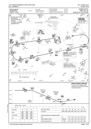
IAC chart of EDQG
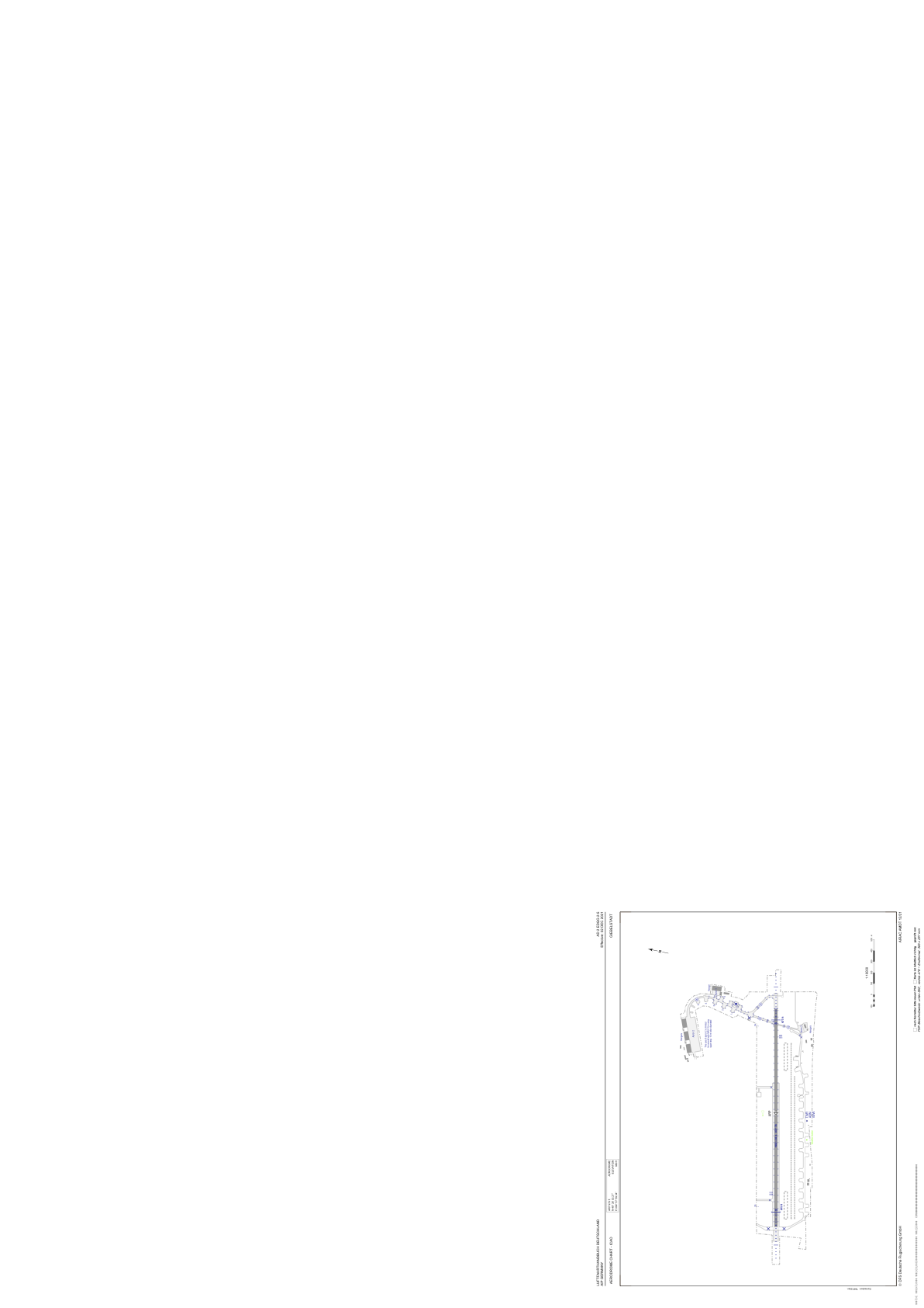
 ADC chart of EDQG
 Satellite view of EDQG
ADC chart of EDQG
Satellite view of EDQG
Sorry, we have no imagery here.
Sorry, we have no imagery here.
Sorry, we have no imagery here.
Sorry, we have no imagery here.
Sorry, we have no imagery here.
Sorry, we have no imagery here.


EDQG - Giebelstadt
Located in Giebelstadt, Germany
ICAO - EDQG, IATA - GHF
Data provided by AirmateGeneral information
Coordinates: N49°38'53" E9°57'59"
Elevation is 979 feet MSL.
Magnetic variation is 2.8000° East View others Airports in Bavaria
Operational data
Special qualification required
Current time UTC:
Current local time:
Weather at : ETHN - Niederstetten ( 28 km )
TAF: TAF ETHN 190423Z 1905/1914 11004KT 9999 NSW SKC
Communications frequencies: [VIEW]
Runways:
| RWY identifier | QFU | Length (ft) | Width (ft) | Surface | LDA (ft) |
| 08 | 0° | 6503 | 98 | UNK | |
| 26 | 0° | 6503 | 98 | UNK |
Airport contact information
Address: Giebelstadt Germany
Other aviation service providers
Aviation club (not for profit)

Satellite view of EDQG
Sorry, we have no imagery here.
Sorry, we have no imagery here.
Sorry, we have no imagery here.
Sorry, we have no imagery here.
Sorry, we have no imagery here.
Sorry, we have no imagery here.