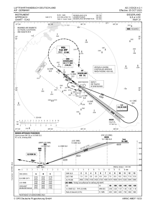
IAC chart of EDGS
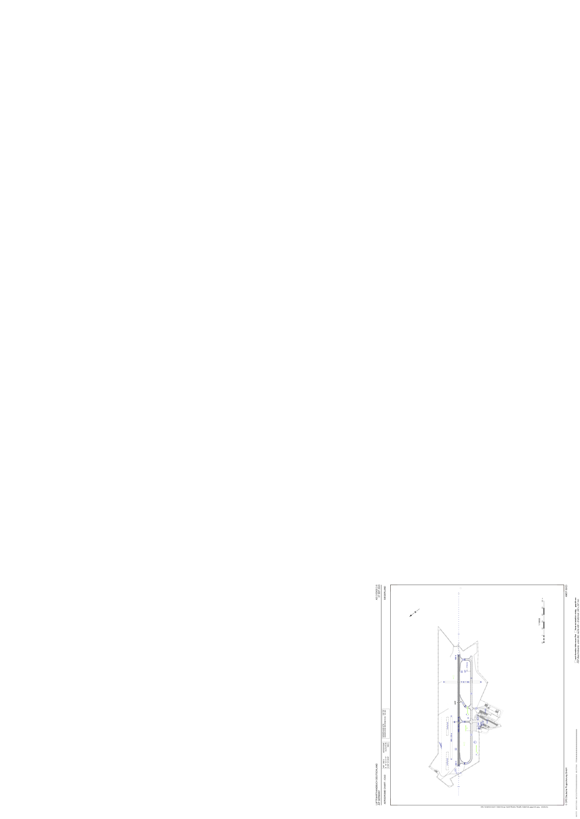
 ADC chart of EDGS
 Satellite view of EDGS
ADC chart of EDGS
Satellite view of EDGS
Sorry, we have no imagery here.
Sorry, we have no imagery here.
Sorry, we have no imagery here.
Sorry, we have no imagery here.
Sorry, we have no imagery here.
Sorry, we have no imagery here.


EDGS - Siegerland
Located in Siegen, Germany
ICAO - EDGS, IATA - SGE
Data provided by AirmateGeneral information
Coordinates: N50°42'28" E8°4'59"
Elevation is 1968 feet MSL.
Magnetic variation is 2.3000° East View others Airports in North Rhine-Westphalia
Operational data
Special qualification required
Current time UTC:
Current local time:
Weather
METAR: EDGS 291920Z AUTO 32006KT 9999 // NCD 05/M04 Q1019
TAF: TAF EDGS 291700Z 2918/3003 33010KT CAVOK BECMG 2918/2921 26005KT
Communications frequencies: [VIEW]
Runways:
| RWY identifier | QFU | Length (ft) | Width (ft) | Surface | LDA (ft) |
| 13 | 128° | 5315 | 98 | ASP | |
| 31 | 308° | 5315 | 98 | ASP | |
| 13G | 0° | 0 | 0 | UNK | |
| 31G | 0° | 0 | 0 | UNK | |
| 04 | 38° | 1640 | 98 | GRS | |
| 22 | 218° | 1640 | 98 | GRS | |
| 13L | 128° | 1969 | 98 | GRS | |
| 31R | 308° | 1969 | 98 | GRS |
Airport contact information
Address: Siegen Germany

Satellite view of EDGS
Sorry, we have no imagery here.
Sorry, we have no imagery here.
Sorry, we have no imagery here.
Sorry, we have no imagery here.
Sorry, we have no imagery here.
Sorry, we have no imagery here.