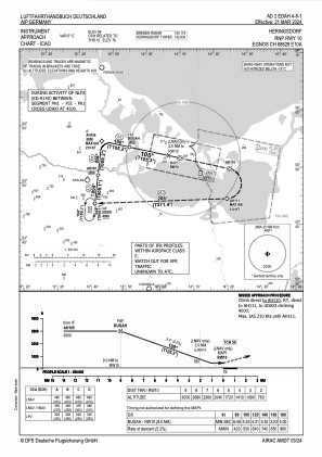
IAC chart of EDAH
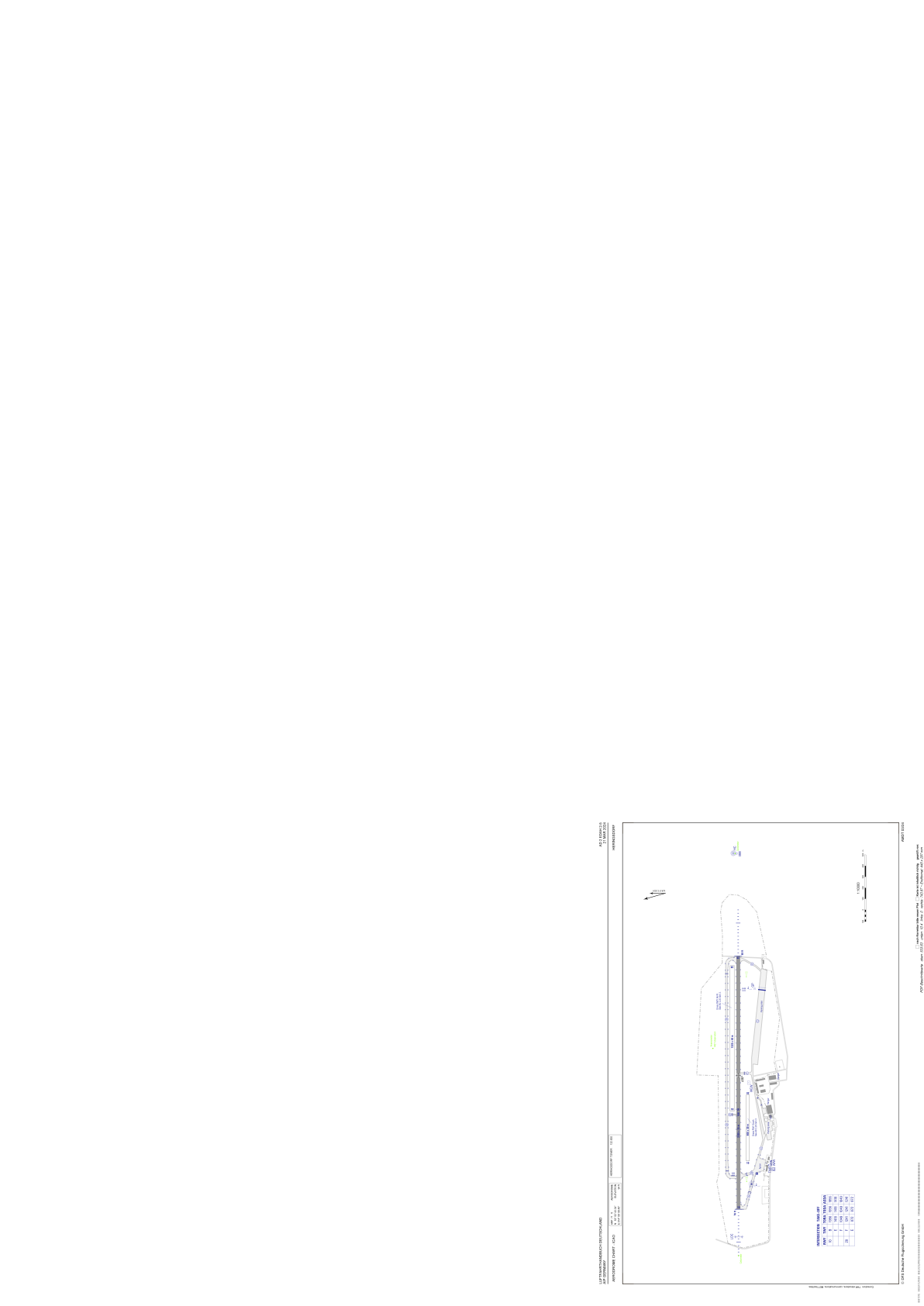
 ADC chart of EDAH
 Satellite view of EDAH
ADC chart of EDAH
Satellite view of EDAH
Sorry, we have no imagery here.
Sorry, we have no imagery here.
Sorry, we have no imagery here.
Sorry, we have no imagery here.
Sorry, we have no imagery here.
Sorry, we have no imagery here.


EDAH - Heringsdorf
Located in Heringsdorf, Germany
ICAO - EDAH, IATA - HDF
Data provided by AirmateGeneral information
Coordinates: N53°52'43" E14°9'8"
Elevation is 94 feet MSL.
Magnetic variation is 5.3000° East View others Airports in Mecklenburg-Vorpommern
Operational data
Special qualification required
Current time UTC:
Current local time:
Weather
METAR: EDAH 200220Z AUTO 27005KT 9999 // NCD 09/08 Q1016
TAF: TAF EDAH 191700Z 1918/2003 34003KT 9999 BKN030
Communications frequencies: [VIEW]
Runways:
| RWY identifier | QFU | Length (ft) | Width (ft) | Surface | LDA (ft) |
| 10 | 106° | 7562 | 115 | ASP | |
| 28 | 286° | 7562 | 115 | ASP | |
| 10N | 0° | 0 | 0 | UNK | |
| 28N | 0° | 0 | 0 | UNK | |
| 10S | 0° | 0 | 0 | UNK | |
| 28S | 0° | 0 | 0 | UNK |
Airport contact information
Address: Heringsdorf Germany
Other aviation service providers
Aviation club (not for profit)

Satellite view of EDAH
Sorry, we have no imagery here.
Sorry, we have no imagery here.
Sorry, we have no imagery here.
Sorry, we have no imagery here.
Sorry, we have no imagery here.
Sorry, we have no imagery here.