


DTTA - Tunis/Carthage
Located in Tunis, Tunisia
ICAO - DTTA, IATA - TUN
Data provided by AirmateGeneral information
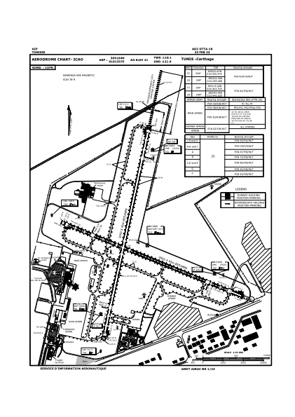
Coordinates: N36°51'4" E10°13'37"
Elevation is 21 feet MSL.
Magnetic variation is 3° East View others Airports in Tunis Governorate
Operational data
Special qualification required
Current time UTC:
Current local time:
Weather
METAR: DTTA 121330Z 02012KT 350V060 9999 FEW026 33/18 Q1011
TAF: TAF DTTA 121100Z 1212/1312 24010KT 9999 FEW026 BECMG 1213/1215 04015KT BECMG 1216/1218 31010KT BECMG 1219/1221 25006KT BECMG 1301/1303 30012KT PROB30 TEMPO 1302/1306 RA SCT026TCU FEW030CB
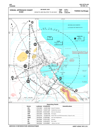
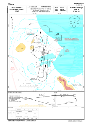
Communications frequencies: [VIEW]
Runways:
| RWY identifier | QFU | Length (ft) | Width (ft) | Surface | LDA (ft) |
| 11 | 112° | 9350 | 148 | ASP | |
| 29 | 292° | 9350 | 148 | ASP | |
| 01 | 12° | 10499 | 148 | ASP | |
| 19 | 192° | 10499 | 148 | ASP |
Airport contact information
Address: Tunis Tunisia