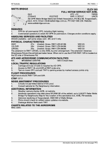
YWSG - Watts Bridge
Located in Toogoolawah, Australia
ICAO - YWSG, IATA -
Data provided by AirmateGeneral information
Coordinates: S27°5'40" E152°27'35"
Elevation is 300 feet MSL.
Magnetic variation is 11° East View others Airports in Queensland
Operational data
Special qualification required
Current time UTC:
Current local time:
Weather at : YAMB - Amberley ( 66 km )
METAR: YAMB 030300Z 07003KT 9999 SCT020 BKN045 OVC200 26/21 Q1008
TAF: TAF YAMB 030220Z 0303/0400 VRB03KT 9999 -SHRA SCT025 BKN040 FM030500 09008KT 9999 -SHRA BKN040 FM031000 VRB03KT 9999 NSW SCT015 BKN030 FM032300 19006KT 9999 SCT030 PROB30 0316/0322 0500 FG BKN001
Communications frequencies: [VIEW]
Runways:
| RWY identifier | QFU | Length (ft) | Width (ft) | Surface | LDA (ft) |
| 03 | 0° | 2657 | 82 | G | |
| 21 | 0° | 2657 | 82 | G | |
| 12L | 0° | 2756 | 98 | UNK | |
| 30R | 0° | 2756 | 98 | UNK | |
| 12R | 0° | 2887 | 98 | UNK | |
| 30L | 0° | 2887 | 98 | UNK | |
| 30 | 309° | 2969 | 94 | GRAS | |
| 12 | 129° | 2969 | 94 | GRAS | |
| 18 | 192° | 3 | 85 | GRAS | |
| 00 | 12° | 3 | 85 | GRAS |
Airport contact information
Address: Toogoolawah Australia
Other aviation service providers
Autres associations d'aviation non-lucratives
Non aviation service providers
Autres associations d'aviation non-lucratives
Satellite view of YWSG
Sorry, we have no imagery here.
Sorry, we have no imagery here.
Sorry, we have no imagery here.
Sorry, we have no imagery here.
Sorry, we have no imagery here.
Sorry, we have no imagery here.


