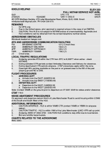
YKHO - Kholo Helipad
Located in Kholo, Australia
ICAO - , IATA -
Data provided by AirmateGeneral information
Coordinates: S27°29'52" E152°46'28"
Elevation is 244 feet MSL.
View others Airports in Queensland
Operational data
Special qualification required
Current time UTC:
Current local time:
Weather at : YAMB - Amberley ( 17 km )
METAR: YAMB 030230Z 01003KT 9999 VCSH SCT020 BKN036 BKN140 25/22 Q1008
TAF: TAF YAMB 030220Z 0303/0400 VRB03KT 9999 -SHRA SCT025 BKN040 FM030500 09008KT 9999 -SHRA BKN040 FM031000 VRB03KT 9999 NSW SCT015 BKN030 FM032300 19006KT 9999 SCT030 PROB30 0316/0322 0500 FG BKN001
Communications frequencies: [VIEW]
Runways:
Airport contact information
Address: Kholo Australia
Satellite view of YKHO
Sorry, we have no imagery here.
Sorry, we have no imagery here.
Sorry, we have no imagery here.
Sorry, we have no imagery here.
Sorry, we have no imagery here.
Sorry, we have no imagery here.


