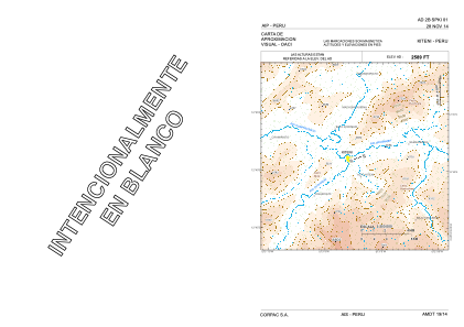
VAC chart of SPKI
 Satellite view of SPKI
Satellite view of SPKI
Sorry, we have no imagery here.
Sorry, we have no imagery here.
Sorry, we have no imagery here.
Sorry, we have no imagery here.
Sorry, we have no imagery here.
Sorry, we have no imagery here.


SPKI - Kiteni
Located in , Peru
ICAO - , IATA -
Data provided by AirmateGeneral information
Coordinates: S12°38'55" W73°2'12"
Elevation is 2589 feet MSL.
View others Airports in Cuzco Region
Operational data
Special qualification required
Current time UTC:
Current local time:
Weather at : - ( 0 km )
METAR: MMSM 101421Z 00000KT 10SM SKC 13/M07 A3046 RMK HZY
Communications frequencies: [VIEW]
Runways:
| RWY identifier | QFU | Length (ft) | Width (ft) | Surface | LDA (ft) |
| 07 | 0° | 3346 | 66 | UNK | |
| 25 | 0° | 3346 | 66 | UNK |
Airport contact information
Address: Peru
Satellite view of SPKI
Sorry, we have no imagery here.
Sorry, we have no imagery here.
Sorry, we have no imagery here.
Sorry, we have no imagery here.
Sorry, we have no imagery here.
Sorry, we have no imagery here.