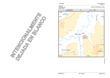
VAC chart of SPEP
 Satellite view of SPEP

Satellite view of SPEP
Sorry, we have no imagery here.
Sorry, we have no imagery here.
Sorry, we have no imagery here.
Sorry, we have no imagery here.
Sorry, we have no imagery here.
Sorry, we have no imagery here.


SPEP - Puerto Esperanza
Located in Puerto Esperanza, Peru
ICAO - SPEP, IATA -
Data provided by AirmateGeneral information
Coordinates: S9°46'13" W70°42'33"
Elevation is 725 feet MSL.
View others Airports in Ucayali Region
Operational data
Special qualification required
Current time UTC:
Current local time:
Weather at : - ( 0 km )
METAR: USDD 171311Z 04006MPS 1600 R04/P2000U SN HZ SCT015 M20/M22 Q1004 R04/490549 NOSIG RMK QFE747/0996
Communications frequencies: [VIEW]
Runways:
| RWY identifier | QFU | Length (ft) | Width (ft) | Surface | LDA (ft) |
| 07 | 71° | 5906 | 98 | ASP | |
| 25 | 251° | 5906 | 98 | ASP |
Airport contact information
Address: Puerto Esperanza Peru
Satellite view of SPEP
Sorry, we have no imagery here.
Sorry, we have no imagery here.
Sorry, we have no imagery here.
Sorry, we have no imagery here.
Sorry, we have no imagery here.
Sorry, we have no imagery here.