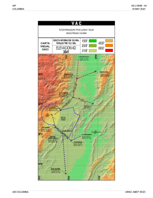
VAC chart of SKIB
 IAC chart of SKIB
 ADC chart of SKIB
 Satellite view of SKIB
IAC chart of SKIBADC chart of SKIB
Satellite view of SKIB
Sorry, we have no imagery here.
Sorry, we have no imagery here.
Sorry, we have no imagery here.
Sorry, we have no imagery here.
Sorry, we have no imagery here.
Sorry, we have no imagery here.


SKIB - Ibague-Perales
Located in Ibague, Colombia
ICAO - SKIB, IATA - IBE
Data provided by AirmateGeneral information
Coordinates: N4°25'18" W75°8'1"
Elevation is 3055 feet MSL.
Magnetic variation is -7° East View others Airports in Tolima
Operational data
Special qualification required
Current time UTC:
Current local time:
Weather
METAR: SKIB 110500Z AUTO VRB02KT //// R32///// // ////// 21/21 Q1020
Communications frequencies: [VIEW]
Runways:
| RWY identifier | QFU | Length (ft) | Width (ft) | Surface | LDA (ft) |
| 14 | 131° | 5906 | 98 | ASPH | 5906 |
| 32 | 311° | 5906 | 98 | ASPH | 5906 |
Airport contact information
Address: Ibague Colombia
Satellite view of SKIB
Sorry, we have no imagery here.
Sorry, we have no imagery here.
Sorry, we have no imagery here.
Sorry, we have no imagery here.
Sorry, we have no imagery here.
Sorry, we have no imagery here.