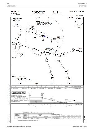
IAC chart of OETR
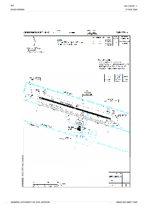
 ADC chart of OETR
 Satellite view of OETR

ADC chart of OETR
Satellite view of OETR
Sorry, we have no imagery here.
Sorry, we have no imagery here.
Sorry, we have no imagery here.
Sorry, we have no imagery here.
Sorry, we have no imagery here.
Sorry, we have no imagery here.


OETR - Turaif
Located in Turaif, Saudi Arabia
ICAO - OETR, IATA - TUI
Data provided by AirmateGeneral information
Coordinates: N31°41'41" E38°43'55"
Elevation is 2809 feet MSL.
View others Airports in The Northern Border
Operational data
Special qualification required
Current time UTC:
Current local time:
Weather
METAR: OETR 250000Z 08008KT CAVOK M03/M16 Q1025 NOSIG
TAF: TAF OETR 242300Z 2500/2606 07005KT 9999 FEW040 BECMG 2506/2508 13010KT BECMG 2518/2520 14007KT
Communications frequencies: [VIEW]
Runways:
| RWY identifier | QFU | Length (ft) | Width (ft) | Surface | LDA (ft) |
| 10 | 105° | 10007 | 148 | ASP | |
| 28 | 285° | 10007 | 148 | ASP |
Airport contact information
Address: Turaif Saudi Arabia
Satellite view of OETR
Sorry, we have no imagery here.
Sorry, we have no imagery here.
Sorry, we have no imagery here.
Sorry, we have no imagery here.
Sorry, we have no imagery here.
Sorry, we have no imagery here.