ADC chart of NE95
 Satellite view of NE95
Satellite view of NE95
Sorry, we have no imagery here.
Sorry, we have no imagery here.
Sorry, we have no imagery here.
Sorry, we have no imagery here.
Sorry, we have no imagery here.
Sorry, we have no imagery here.


NE95 - Frenchman
Located in Culbertson, United States
ICAO - NE95, IATA -
Data provided by AirmateGeneral information
Coordinates: N40°13'46" W100°51'25"
Elevation is 2590 feet MSL.
View others Airports in Nebraska
Operational data
Special qualification required
Current time UTC:
Current local time:
Weather at : KMCK - Mc Cook Ben Nelson Rgnl ( 23 km )
METAR: KMCK 051253Z AUTO 31011KT 10SM CLR M04/M07 A3043 RMK AO2 SLP330 T10441072 $
TAF: KMCK 051120Z 0512/0612 34007KT P6SM SCT220 FM051430 35015G25KT P6SM SCT220 FM051900 35015G20KT P6SM SCT220 FM060100 02007KT P6SM FEW230 TEMPO 0604/0608 VRB04KT FM060800 26003KT P6SM SKC
Communications frequencies: [VIEW]
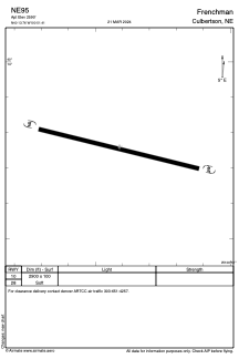
Runways:
| RWY identifier | QFU | Length (ft) | Width (ft) | Surface | LDA (ft) |
| 10 | 0° | 2900 | 100 | GRASS | |
| 28 | 0° | 2900 | 100 | GRASS |
Airport contact information
Address: Culbertson United States
Satellite view of NE95
Sorry, we have no imagery here.
Sorry, we have no imagery here.
Sorry, we have no imagery here.
Sorry, we have no imagery here.
Sorry, we have no imagery here.
Sorry, we have no imagery here.