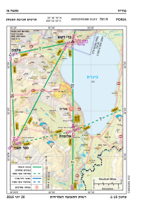
VAC chart of LLPO
 Satellite view of LLPO
Satellite view of LLPO
Sorry, we have no imagery here.
Sorry, we have no imagery here.
Sorry, we have no imagery here.
Sorry, we have no imagery here.
Sorry, we have no imagery here.
Sorry, we have no imagery here.


LLPO - Poria
Located in , Israel
ICAO - , IATA -
Data provided by AirmateGeneral information
Coordinates: N32°45'15" E35°32'33"
Elevation is 716 feet MSL.
View others Airports in North District
Operational data
Special qualification required
Current time UTC:
Current local time:
Weather at : LLIB - Rosh Pina ( 25 km )
METAR: LLIB 100350Z AUTO 28007KT 9999 SCT050 14/07 Q1015
TAF: TAF LLIB 100301Z 1004/1024 30008KT 9999 SCT035 PROB40 TEMPO 1004/1007 -RA BKN025 BECMG 1007/1009 28014KT PROB40 TEMPO 1009/1015 -RA BKN025 BECMG 1015/1017 VRB04KT PROB40 TEMPO 1017/1024 26008KT -RA BKN025 TX20/1012Z TN14/1004Z
Communications frequencies: [VIEW]
Runways:
Airport contact information
Address: Israel
Satellite view of LLPO
Sorry, we have no imagery here.
Sorry, we have no imagery here.
Sorry, we have no imagery here.
Sorry, we have no imagery here.
Sorry, we have no imagery here.
Sorry, we have no imagery here.