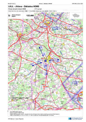
VAC chart of LKJL
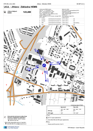
 ADC chart of LKJL
 Satellite view of LKJL

ADC chart of LKJL
Satellite view of LKJL
Sorry, we have no imagery here.
Sorry, we have no imagery here.
Sorry, we have no imagery here.
Sorry, we have no imagery here.
Sorry, we have no imagery here.
Sorry, we have no imagery here.


LKJL - Jihlava - Zakladna Hems
Located in Jihlava, Czech Republic
ICAO - , IATA -
Data provided by AirmateGeneral information
Coordinates: N49°23'55" E15°34'5"
Elevation is 1752 feet MSL.
View others Airports in Vysocina Region
Operational data
Special qualification required
Current time UTC:
Current local time:
Weather at : LKNA - Namest ( 48 km )
METAR: LKNA 190330Z 11003KT CAVOK M02/M09 Q1029 RMK BLU
TAF: TAF LKNA 190500Z 1906/2006 10007KT CAVOK TEMPO 1908/1917 13010KT TEMPO 1922/2006 06005KT
Communications frequencies: [VIEW]
Runways:
Airport contact information
Address: Jihlava Czech Republic
Satellite view of LKJL
Sorry, we have no imagery here.
Sorry, we have no imagery here.
Sorry, we have no imagery here.
Sorry, we have no imagery here.
Sorry, we have no imagery here.
Sorry, we have no imagery here.