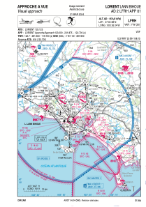
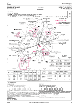
LFRH - Lorient Lann Bihoue
Located in Qu, France
ICAO - LFRH, IATA - LRT
Data provided by AirmateGeneral information
Coordinates: N47°45'38" W3°26'24"
Elevation is 159 feet MSL.
Magnetic variation is -0.73° East View others Airports in Brittany
Operational data
Special qualification required
Current time UTC:
Current local time:
Weather
METAR: LFRH 211600Z AUTO 34013KT 310V020 9999 BKN023 05/02 Q0998 NOSIG
TAF: TAF LFRH 211100Z 2112/2212 27025G45KT 9999 NSW BKN025 OVC030 TEMPO 2112/2113 27030G55KT PROB40 TEMPO 2112/2113 28030G62KT BECMG 2113/2115 34015G40KT BECMG 2115/2118 34010KT BECMG 2118/2120 VRB05KT BKN020 TEMPO 2122/2202 4000 RA BKN008 OVC012 BECMG 2201/2203 CAVOK PROB30 TEMPO 2203/2206 3000 BR BECMG 2207/2209 28010KT TEMPO 2207/2209 BKN025
Communications frequencies: [VIEW]
Runways:
| RWY identifier | QFU | Length (ft) | Width (ft) | Surface | LDA (ft) |
| 02 | 16° | 5479 | 148 | CONC | 5479 |
| 20 | 196° | 5479 | 148 | CONC | 5479 |
| 07 | 72° | 7884 | 148 | CONC | 7884 |
| 25 | 252° | 7884 | 148 | CONC | 7316 |
Airport contact information
Address: Qu France


