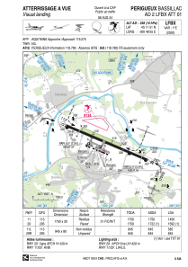
VAC chart of LFBX
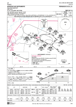
IAC chart of LFBX
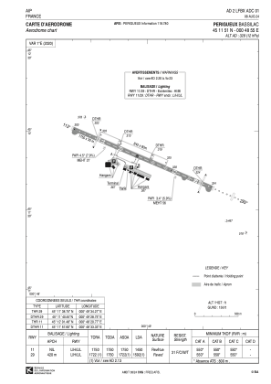
ADC chart of LFBX
Satellite view of LFBX
←
Move left
→
Move right
↑
Move up
↓
Move down
+
Zoom in
-
Zoom out
Home
Jump left by 75%
End
Jump right by 75%
Page Up
Jump up by 75%
Page Down
Jump down by 75%
Sorry, we have no imagery here.
To navigate, press the arrow keys.
Keyboard shortcuts
Map Data
Image may be subject to copyright
1 km
Click to toggle between metric and imperial units
Terms
Report a map error
LFBX - Perigueux Bassillac
Located in Perigueux, France
ICAO - LFBX, IATA - PGX
Data provided by
Airmate
General information
Coordinates:
N45°11'51" E0°48'55"
Elevation is
328 feet MSL.
Magnetic variation is
0.76° East
Rated:
View ratings:
[VIEW]
Add your vote
Valid your vote
View others
Airports in
Aquitaine
Operational data
Special qualification required
Current time UTC:
Current local time:
Weather
METAR:
LFBX 031100Z AUTO 14008KT 090V210 CAVOK 18/07 Q1014
View NOTAMs / SUP AIP / TFR affecting this airport
[VIEW]
Communications frequencies:
[VIEW]
Runways:
RWY identifier
QFU
Length
(ft)
Width
(ft)
Surface
LDA
(ft)
11L
114°
2772
262
GRASS
1919
29R
294°
2772
262
GRASS
2116
11
114°
5741
98
ASPH
4757
29
294°
5741
98
ASPH
5223
Airport contact information
Address:
Perigueux France
Handlers
Communaute D'agglomeration Le Grand Perigueux
[VIEW]
[VIEW]
Add your vote
Valid your vote
Fuel provider
WEB
TotalEnergies
TotalEnergies
+33 553027975
Add your vote
Valid your vote
Other aviation service providers
Aviation club (not for profit)
WEB
Association Sportive Aéronautique de Périgueux
aeroclub.perigueux@gmail.com
+33553544119
Add your vote
Valid your vote
Aviation medical examiner
WEB
Dr Pele Patrice
Dr Pele Patrice
+33 553534311
Add your vote
Valid your vote
Satellite view of LFBX
←
Move left
→
Move right
↑
Move up
↓
Move down
+
Zoom in
-
Zoom out
Home
Jump left by 75%
End
Jump right by 75%
Page Up
Jump up by 75%
Page Down
Jump down by 75%
Sorry, we have no imagery here.
To navigate, press the arrow keys.
Keyboard shortcuts
Map Data
Image may be subject to copyright
1 km
Click to toggle between metric and imperial units
Terms
Report a map error
<<
BESbswy
BESbswy