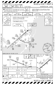
KHST - Homestead Arb
Located in Homestead, United States
ICAO - HST, IATA - HST
Data provided by AirmateGeneral information
Coordinates: N25°29'19" W80°23'1"
Elevation is 5 feet MSL.
Magnetic variation is -06° East View others Airports in Florida
Operational data
Special qualification required
Current time UTC:
Current local time:
Weather
METAR: KHST 042355Z AUTO 07007KT 10SM CLR 26/21 A3018 RMK AO2 SLP223 60000 T02580206 10293 20255 50003
TAF: TAF KHST 041900Z 0419/0601 11012G22KT 9999 FEW022 SCT040 SCT120 QNH3016INS BECMG 0423/0424 10010G15KT 9999 FEW018 SCT025 510082 QNH3013INS TEMPO 0503/0509 VCSH SCT015 BKN020 WND 070V130 BECMG 0514/0515 12015G25KT 9999 SCT028 QNH3017INS TX28/0419Z TN24/0511Z
Communications frequencies: [VIEW]
Runways:
| RWY identifier | QFU | Length (ft) | Width (ft) | Surface | LDA (ft) |
| 06 | 0° | 11202 | 300 | CONC | |
| 24 | 0° | 11202 | 300 | CONC |
Airport contact information
Address: Homestead United States
Satellite view of KHST
Sorry, we have no imagery here.
Sorry, we have no imagery here.
Sorry, we have no imagery here.
Sorry, we have no imagery here.
Sorry, we have no imagery here.
Sorry, we have no imagery here.


