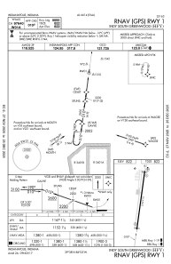
IAC chart of KHFY
 Satellite view of KHFY
Satellite view of KHFY
Sorry, we have no imagery here.
Sorry, we have no imagery here.
Sorry, we have no imagery here.
Sorry, we have no imagery here.
Sorry, we have no imagery here.
Sorry, we have no imagery here.


KHFY - Indy South Greenwood
Located in Indianapolis, United States
ICAO - HFY, IATA -
Data provided by AirmateGeneral information
Coordinates: N39°37'39" W86°5'17"
Elevation is 822 feet MSL.
Magnetic variation is -02° East View others Airports in Indiana
Operational data
Special qualification required
Current time UTC:
Current local time:
Weather at : KIND - Indianapolis Intl ( 20 km )
METAR: KIND 051254Z 11004G17KT 2SM -RA BR BKN009 OVC015 14/13 A2987 RMK AO2 SFC VIS 4 PRESFR SLP116 P0007 T01390133 $
TAF: KIND 051132Z 0512/0618 19008KT P6SM -SHRA OVC020 TEMPO 0512/0514 2SM SHRA BR OVC006 FM051400 29008KT 4SM -SHRA BR OVC026 TEMPO 0514/0515 2SM SHRA BR OVC004 FM051700 33009KT 6SM -SHRA BR OVC007 FM052000 35010KT 3SM SHRA BR OVC007 PROB30 0521/0524 SHRA OVC090 FM060000 01011G21KT 3SM -SHRA BR OVC011 FM060400 02011G22KT P6SM -RA SCT014 OVC023
Communications frequencies: [VIEW]
Runways:
| RWY identifier | QFU | Length (ft) | Width (ft) | Surface | LDA (ft) |
| 01 | 8° | 5102 | 75 | ASPH | |
| 19 | 188° | 5102 | 75 | ASPH |
Airport contact information
Address: Indianapolis United States
Other aviation service providers
Flight schools

Satellite view of KHFY
Sorry, we have no imagery here.
Sorry, we have no imagery here.
Sorry, we have no imagery here.
Sorry, we have no imagery here.
Sorry, we have no imagery here.
Sorry, we have no imagery here.