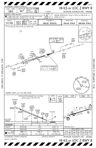
IAC chart of KGSB
 ADC chart of KGSB
 Satellite view of KGSB
ADC chart of KGSB
Satellite view of KGSB
Sorry, we have no imagery here.
Sorry, we have no imagery here.
Sorry, we have no imagery here.
Sorry, we have no imagery here.
Sorry, we have no imagery here.
Sorry, we have no imagery here.


KGSB - Seymour Johnson Afb
Located in Goldsboro, United States
ICAO - GSB, IATA - GSB
Data provided by AirmateGeneral information
Coordinates: N35°20'22" W77°57'38"
Elevation is 109 feet MSL.
Magnetic variation is -08° East View others Airports in North Carolina
Operational data
Special qualification required
Current time UTC:
Current local time:
Weather
METAR: KGSB 020555Z 09007KT 10SM SCT200 12/08 A3020 RMK AO2A SLP230 T01160081 10189 20115 51011 $
TAF: TAF KGSB 020400Z 0204/0310 14009KT 9999 FEW180 QNH3018INS BECMG 0206/0207 13009KT 9999 BKN030 QNH3020INS BECMG 0208/0209 12006KT 9999 BKN025 QNH3023INS TEMPO 0209/0214 BKN018 BECMG 0214/0215 12010G15KT 9999 SCT025 BKN050 QNH3017INS TX21/0220Z TN10/0211Z
Communications frequencies: [VIEW]
Runways:
| RWY identifier | QFU | Length (ft) | Width (ft) | Surface | LDA (ft) |
| 08 | 73° | 11760 | 300 | CONC | |
| 26 | 253° | 11760 | 300 | CONC |
Airport contact information
Address: Goldsboro United States
Satellite view of KGSB
Sorry, we have no imagery here.
Sorry, we have no imagery here.
Sorry, we have no imagery here.
Sorry, we have no imagery here.
Sorry, we have no imagery here.
Sorry, we have no imagery here.