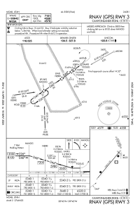
IAC chart of KCNY
 Satellite view of KCNY
Satellite view of KCNY
Sorry, we have no imagery here.
Sorry, we have no imagery here.
Sorry, we have no imagery here.
Sorry, we have no imagery here.
Sorry, we have no imagery here.


KCNY - Canyonlands Rgnl
Located in Moab, United States
ICAO - CNY, IATA - CNY
Data provided by AirmateGeneral information
Coordinates: N38°45'27" W109°45'12"
Elevation is 4579 feet MSL.
Magnetic variation is 10° East View others Airports in Utah
Operational data
Special qualification required
Current time UTC:
Current local time:
Weather
METAR: KCNY 011453Z AUTO 21008KT 10SM OVC100 04/M02 A2959 RMK AO2 SLP995 60000 T00441022 53004
TAF: KCNY 011140Z 0112/0212 30025G35KT P6SM VCSH SCT050 BKN080 FM011900 28020G30KT P6SM VCSH SCT060 BKN080 FM020200 30011KT P6SM FEW090 SCT250 FM020500 VRB05KT P6SM FEW080 FM020800 00000KT P6SM SKC
Communications frequencies: [VIEW]
Runways:
| RWY identifier | QFU | Length (ft) | Width (ft) | Surface | LDA (ft) |
| 03 | 40° | 7360 | 100 | ASPH | 7101 |
| 21 | 220° | 7360 | 100 | ASPH | 7101 |
| 15 | 158° | 2121 | 60 | GRAVEL | 2000 |
| 33 | 338° | 2121 | 60 | GRAVEL | 2000 |
Airport contact information
Address: Moab United States
Satellite view of KCNY
Sorry, we have no imagery here.
Sorry, we have no imagery here.
Sorry, we have no imagery here.
Sorry, we have no imagery here.
Sorry, we have no imagery here.