VAC chart of EGSPIL
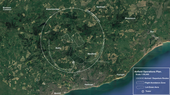 Satellite view of EGSPIL
Satellite view of EGSPIL
Sorry, we have no imagery here.
Sorry, we have no imagery here.
Sorry, we have no imagery here.
Sorry, we have no imagery here.
Sorry, we have no imagery here.
Sorry, we have no imagery here.


EGSPIL - Spilsted Farm
Located in Whatlington, United Kingdom
ICAO - , IATA -
Data provided by AirmateGeneral information
Coordinates: N50°56'13" E0°31'9"
Elevation is 160 feet MSL.
Magnetic variation is 1° East View others Airports in England
Operational data
Special qualification required
Current time UTC:
Current local time:
Weather at : EGMD - Lydd ( 29 km )
METAR: EGMD 312050Z AUTO 06011KT 9999 NCD 07/06 Q1029
TAF: TAF EGMD 311955Z 3121/0106 08014KT CAVOK PROB30 TEMPO 3121/3124 BKN014
Communications frequencies: [VIEW]
Runways:
| RWY identifier | QFU | Length (ft) | Width (ft) | Surface | LDA (ft) |
| 33 | 335° | 2483 | 46 | GRAS | |
| 15 | 155° | 2483 | 46 | GRAS | |
| 01 | 9° | 1456 | 60 | GRAS | |
| 19 | 189° | 1456 | 60 | GRAS |
Airport contact information
Address: Whatlington United Kingdom
Satellite view of EGSPIL
Sorry, we have no imagery here.
Sorry, we have no imagery here.
Sorry, we have no imagery here.
Sorry, we have no imagery here.
Sorry, we have no imagery here.
Sorry, we have no imagery here.