IAC chart of EDFH
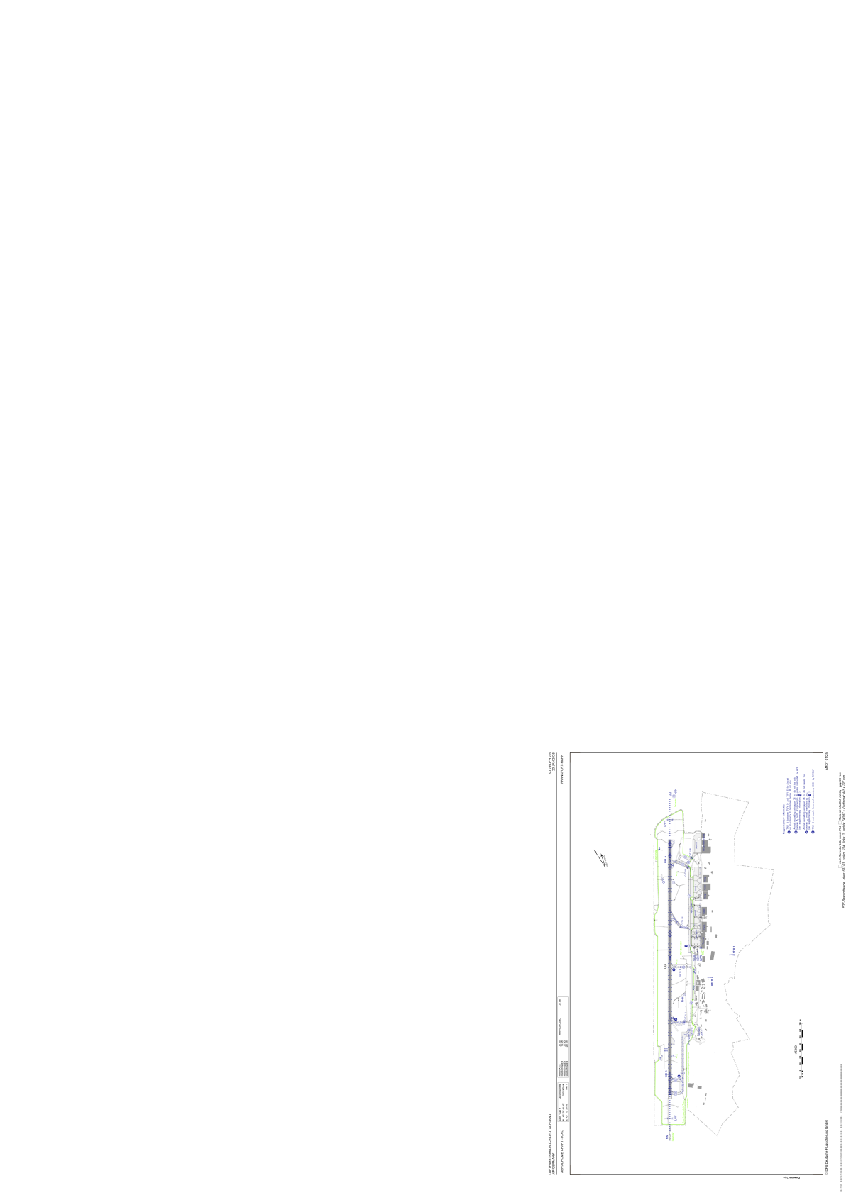
 ADC chart of EDFH
 Satellite view of EDFH
ADC chart of EDFH
Satellite view of EDFH
Sorry, we have no imagery here.
Sorry, we have no imagery here.
Sorry, we have no imagery here.
Sorry, we have no imagery here.
Sorry, we have no imagery here.
Sorry, we have no imagery here.


EDFH - Frankfurt-Hahn
Located in Kirchberg, Germany
ICAO - EDFH, IATA - HHN
Data provided by AirmateGeneral information
Coordinates: N49°56'45" E7°15'40"
Elevation is 1646 feet MSL.
Magnetic variation is 2.0500° East View others Airports in Rhineland-Palatinate
Operational data
Special qualification required
Current time UTC:
Current local time:
Weather
METAR: EDFH 210950Z 36005KT 290V050 CAVOK 17/05 Q1014
TAF: TAF EDFH 210500Z 2106/2206 VRB03KT CAVOK BECMG 2106/2109 32007KT PROB40 TEMPO 2120/2202 SHRA BKN050TCU
Communications frequencies: [VIEW]
Runways:
| RWY identifier | QFU | Length (ft) | Width (ft) | Surface | LDA (ft) |
| 03 | 32° | 12467 | 148 | ASP | |
| 21 | 212° | 12467 | 148 | ASP |
Airport contact information
Address: Kirchberg Germany
Satellite view of EDFH
Sorry, we have no imagery here.
Sorry, we have no imagery here.
Sorry, we have no imagery here.
Sorry, we have no imagery here.
Sorry, we have no imagery here.
Sorry, we have no imagery here.