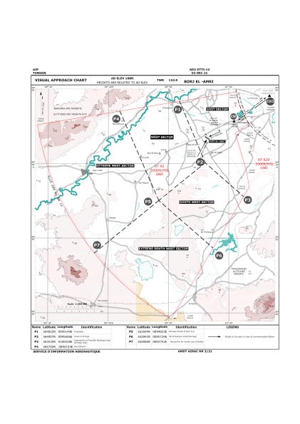
VAC chart of DTTI
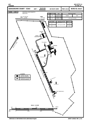
 ADC chart of DTTI
 Satellite view of DTTI
ADC chart of DTTI
Satellite view of DTTI
Sorry, we have no imagery here.
Sorry, we have no imagery here.
Sorry, we have no imagery here.
Sorry, we have no imagery here.
Sorry, we have no imagery here.
Sorry, we have no imagery here.


DTTI - Borj-El Amri
Located in Tunis, Tunisia
ICAO - DTTI, IATA -
Data provided by AirmateGeneral information
Coordinates: N36°43'16" E9°56'36"
Elevation is 109 feet MSL.
Magnetic variation is 3° East View others Airports in Ben Arous Governorate
Operational data
Special qualification required
Current time UTC:
Current local time:
Weather at : DTTA - Tunis/Carthage ( 29 km )
METAR: DTTA 111930Z 11008KT 060V150 9999 FEW023 17/14 Q1018
TAF: TAF DTTA 111700Z 1118/1218 11010KT CAVOK BECMG 1200/1202 VRB02KT BECMG 1209/1211 07010KT
Communications frequencies: [VIEW]
Runways:
| RWY identifier | QFU | Length (ft) | Width (ft) | Surface | LDA (ft) |
| 12 | 126° | 3609 | 98 | UNK | |
| 30 | 306° | 3609 | 98 | UNK |
Airport contact information
Address: Tunis Tunisia
Satellite view of DTTI
Sorry, we have no imagery here.
Sorry, we have no imagery here.
Sorry, we have no imagery here.
Sorry, we have no imagery here.
Sorry, we have no imagery here.
Sorry, we have no imagery here.