BIKF - Keflavik
Located in Keflavik, Iceland
ICAO - BIKF, IATA - KEF
Data provided by AirmateGeneral information
Coordinates: N63°59'6" W22°36'20"
Elevation is 170 feet MSL.
View others Airports in Southern Peninsula
Operational data
Special qualification required
Current time UTC:
Current local time:
Weather
METAR: BIKF 071700Z 14016KT 7000 BR BKN005 OVC033 08/08 Q1021
TAF: TAF BIKF 071603Z 0718/0818 13017KT 8000 -DZ BR BKN010 OVC017 TX09/0815Z TN07/0804Z TEMPO 0718/0721 0500 DZ FG OVC002 TEMPO 0721/0808 2000 DZ BR BKN005 OVC010
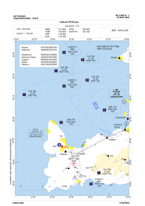
Communications frequencies: [VIEW]
Runways:
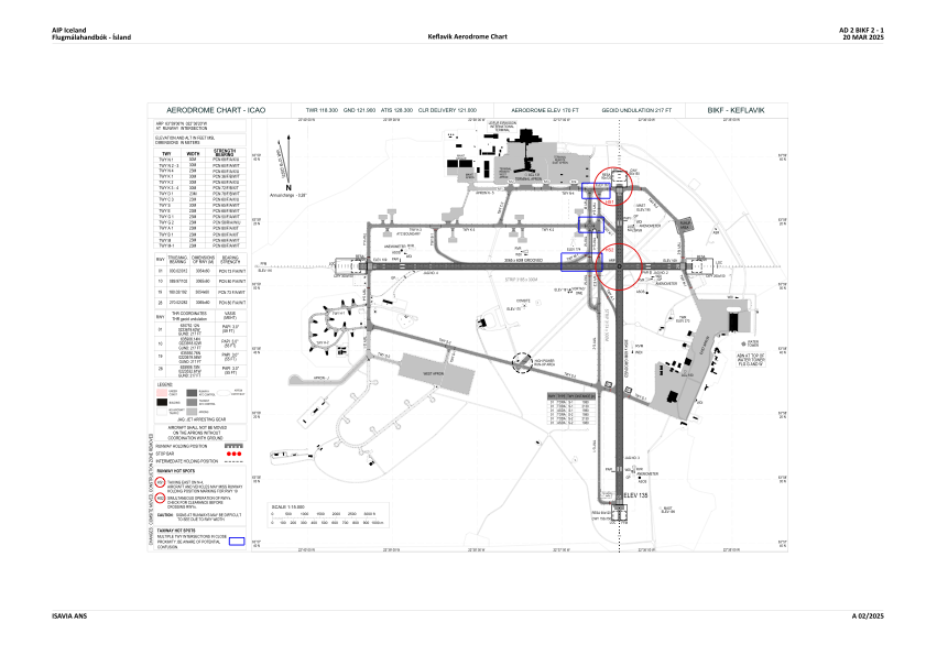
| RWY identifier | QFU | Length (ft) | Width (ft) | Surface | LDA (ft) |
| 01 | 0° | 10020 | 197 | ASPH | |
| 19 | 180° | 10020 | 197 | ASPH | |
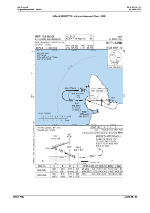
| 10 | 90° | 10056 | 197 | ASPH | |
| 28 | 270° | 10056 | 197 | ASPH |
Airport contact information
Address: Keflavik Iceland
Satellite view of BIKF
Sorry, we have no imagery here.
Sorry, we have no imagery here.
Sorry, we have no imagery here.
Sorry, we have no imagery here.
Sorry, we have no imagery here.
Sorry, we have no imagery here.


