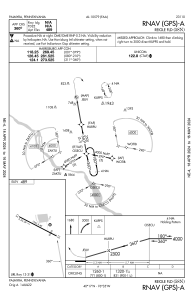
IAC chart of 58N
 ADC chart of 58N
 Satellite view of 58N
ADC chart of 58N
Satellite view of 58N
Sorry, we have no imagery here.
Sorry, we have no imagery here.
Sorry, we have no imagery here.
Sorry, we have no imagery here.
Sorry, we have no imagery here.
Sorry, we have no imagery here.


58N - Reigle Fld
Located in Palmyra, United States
ICAO - 58N, IATA -
Data provided by AirmateGeneral information
Coordinates: N40°17'12" W76°34'37"
Elevation is 489 feet MSL.
Magnetic variation is -10° East View others Airports in Pennsylvania
Operational data
Special qualification required
Current time UTC:
Current local time:
Weather at : KMUI - Muir Ahp (Fort Indiantown Gap) ( 17 km )
METAR: KMUI 081655Z 27014G26KT 10SM BKN055 05/M10 A2982 RMK AO2A PK WND 26028/22 SLP104 T00521102
TAF: TAF KMUI 081100Z 0811/0917 30009KT 9999 FEW200 QNH2975INS BECMG 0813/0814 30020G35KT 9999 BKN045 510003 QNH2981INS BECMG 0823/0824 30009KT 9999 SKC QNH2992INS TX05/0820Z TNM03/0911Z
Communications frequencies: [VIEW]
Runways:
| RWY identifier | QFU | Length (ft) | Width (ft) | Surface | LDA (ft) |
| 13 | 117° | 1955 | 40 | ASPH | |
| 31 | 297° | 1955 | 40 | ASPH |
Airport contact information
Address: Palmyra United States
Other aviation service providers
Flight schools

Satellite view of 58N
Sorry, we have no imagery here.
Sorry, we have no imagery here.
Sorry, we have no imagery here.
Sorry, we have no imagery here.
Sorry, we have no imagery here.
Sorry, we have no imagery here.