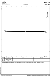
4AR2 - Red Oak
Located in Cabot, United States
ICAO - 4AR2, IATA -
Data provided by AirmateGeneral information
Coordinates: N34°54'38" W92°0'25"
Elevation is 315 feet MSL.
Magnetic variation is 02° East View others Airports in Arkansas
Operational data
Special qualification required
Current time UTC:
Current local time:
Weather at : KLRF - Little Rock Afb ( 13 km )
METAR: KLRF 041055Z AUTO 06008KT 10SM OVC003 13/12 A2993 RMK AO2 LTG DSNT N-NE RAB0955E0957RAB0957E0957 TSB0955E00TSB01E29 SLP138 P0000 T01300121
TAF: TAF AMD KLRF 041100Z 0411/0513 07007KT 8000 BR OVC003 QNH2993INS TEMPO 0411/0415 9000 -SHRA BECMG 0418/0419 15011G22KT 6000 TSRA BR BKN007CB OVC015 QNH2990INS BECMG 0504/0505 18012G25KT 8000 RA BR OVC010 QNH2983INS TEMPO 0505/0510 6000 TSRA BR OVC008CB BECMG 0511/0512 16009KT 8000 -SHRA OVC015 QNH2979INS TX28/0420Z TN12/0412Z
Communications frequencies: [VIEW]
Runways:
| RWY identifier | QFU | Length (ft) | Width (ft) | Surface | LDA (ft) |
| 09 | 0° | 3700 | 100 | GRASS | |
| 27 | 0° | 3700 | 100 | GRASS |
Airport contact information
Address: Cabot United States
Satellite view of 4AR2
Sorry, we have no imagery here.
Sorry, we have no imagery here.
Sorry, we have no imagery here.
Sorry, we have no imagery here.
Sorry, we have no imagery here.
Sorry, we have no imagery here.


