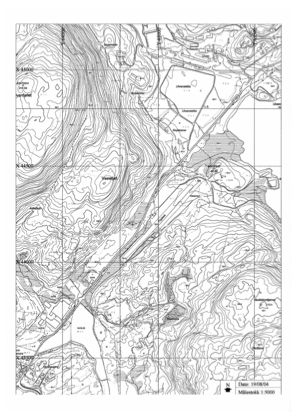
VAC chart of ENUL
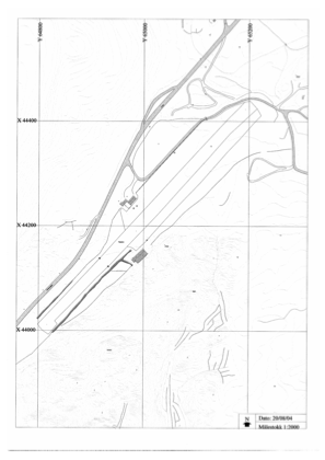
 ADC chart of ENUL
 Satellite view of ENUL

ADC chart of ENUL
Satellite view of ENUL
Sorry, we have no imagery here.
Sorry, we have no imagery here.
Sorry, we have no imagery here.
Sorry, we have no imagery here.
Sorry, we have no imagery here.
Sorry, we have no imagery here.


ENUL - Vaksinen
Located in Ulven, Norway
ICAO - ENUL, IATA -
Data provided by AirmateGeneral information
Coordinates: N60°11'29" E5°25'14"
Elevation is 180 feet MSL.
Magnetic variation is 1.5° East View others Airports in Hordaland
Operational data
Special qualification required
Current time UTC: 21:29:55
Current local time:
Weather at : ENBR - Flesland ( 16 km )
METAR: ENBR 272120Z 18013KT 9999 -SHRA FEW012 OVC044 10/08 Q1002 RMK WIND 1200FT 20018KT
TAF: TAF ENBR 271700Z 2718/2818 23010KT 9999 BKN018 TEMPO 2718/2808 4000 SHRA BKN010 SCT018CB PROB40 TEMPO 2808/2818 BKN018CB
Communications frequencies: [VIEW]
Runways:
| RWY identifier | QFU | Length (ft) | Width (ft) | Surface | LDA (ft) |
| 05 | 0° | 1903 | 82 | Grass | |
| 23 | 0° | 1903 | 82 | Grass |
Airport contact information
Address: Ulven Norway
Satellite view of ENUL
Sorry, we have no imagery here.
Sorry, we have no imagery here.
Sorry, we have no imagery here.
Sorry, we have no imagery here.
Sorry, we have no imagery here.
Sorry, we have no imagery here.