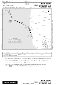
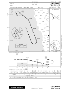
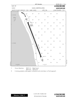


NVSO - Lonorore
Located in , Vanuatu
ICAO - NVSO, IATA - LNE
Data provided by AirmateGeneral information
Coordinates: S15°51'56" E168°10'18"
Elevation is 39 feet MSL.
View others Airports in Penama
Operational data
Special qualification required
Current time UTC:
Current local time:
Weather at : NVSG - Longana ( 66 km )
TAF: TAF NVSG 271700Z 2718/2818 14006KT 9000 -SHRA BKN018 OVC100 INTER 2718/2721 6000 TSRA FEW008 FEW016CB BKN017 OVC090 INTER 2718/2724 8000 SHRA BKN018 OVC040
Communications frequencies: [VIEW]
Runways:
| RWY identifier | QFU | Length (ft) | Width (ft) | Surface | LDA (ft) |
| 15 | 0° | 4009 | 72 | Grass | |
| 33 | 0° | 4009 | 72 | Grass |
Airport contact information
Address: Vanuatu