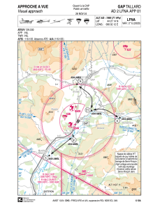
LFNA - Gap Tallard
Located in Gap, France
ICAO - LFNA, IATA - GAT
Data provided by AirmateGeneral information
Coordinates: N44°27'14" E6°2'12"
Elevation is 1966 feet MSL.
Magnetic variation is 2.12° East View others Airports in Provence-Alpes-Côte-d'Azur
Operational data
Special qualification required
Current time UTC:
Current local time:
Communications frequencies: [VIEW]
Runways:
| RWY identifier | QFU | Length (ft) | Width (ft) | Surface | LDA (ft) |
| 02 | 26° | 3100 | 98 | ASPH | 3100 |
| 20 | 206° | 3100 | 98 | ASPH | 2346 |
| 02L | 26° | 2297 | 262 | GRASS | 2297 |
| 20R | 206° | 2297 | 262 | GRASS | 1608 |
| 02R | 26° | 1312 | 197 | GRASS | 1312 |
| 20L | 206° | 1312 | 197 | GRASS | 1312 |
Airport contact information
Address: Gap France
Other aviation service providers
Aviation club (not for profit)
Aéroclub du Val de Durance
Aéroclub du Val de Durance
contact@aeroclub-val-durance.fr+33492541470
+33673974239
+33673974239


