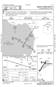
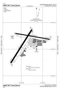
KWVI - Watsonville Muni
Located in Watsonville, United States
ICAO - WVI, IATA - WVI
Data provided by AirmateGeneral information
Coordinates: N36°56'9" W121°47'23"
Elevation is 163 feet MSL.
Magnetic variation is 14° East View others Airports in California
Operational data
Special qualification required
Current time UTC:
Current local time:
Weather
METAR: KWVI 232053Z AUTO 25005KT 10SM CLR 16/09 A2998 RMK AO2 SLP151 T01610094 58010
Communications frequencies: [VIEW]
Runways:
| RWY identifier | QFU | Length (ft) | Width (ft) | Surface | LDA (ft) |
| 02 | 32° | 4502 | 149 | ASPH | |
| 20 | 212° | 4502 | 149 | ASPH | |
| 09 | 100° | 3998 | 98 | ASPH | |
| 27 | 280° | 3998 | 98 | ASPH |
Airport contact information
Address: Watsonville United States
Other aviation service providers
Repair station
Flight schools
Ocean Air Flight Services, Inc.
Ocean Air Flight Services, Inc.
mail@oceanairflightservices.com+1(831)763-0290


