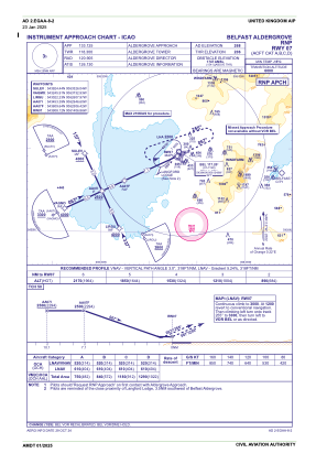
IAC chart of EGAA
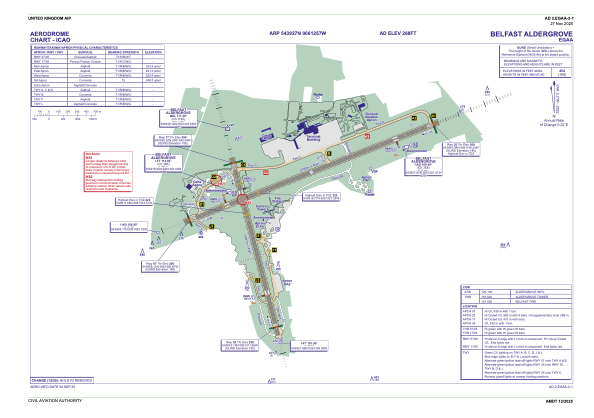
 ADC chart of EGAA
 Satellite view of EGAA

ADC chart of EGAA
Satellite view of EGAA
Sorry, we have no imagery here.
Sorry, we have no imagery here.
Sorry, we have no imagery here.
Sorry, we have no imagery here.
Sorry, we have no imagery here.
Sorry, we have no imagery here.


EGAA - Belfast Aldergrove
Located in Belfast, United Kingdom
ICAO - EGAA, IATA - BFS
Data provided by AirmateGeneral information
Coordinates: N54°39'27" W6°12'57"
Elevation is 268 feet MSL.
View others Airports in Northern Ireland
Operational data
Special qualification required
Current time UTC: 20:53:44
Current local time:
Weather
METAR: EGAA 302020Z AUTO 26008KT 9999 NCD 16/12 Q1014
Communications frequencies: [VIEW]
Runways:
| RWY identifier | QFU | Length (ft) | Width (ft) | Surface | LDA (ft) |
| 17 | 162° | 6204 | 148 | ASP | |
| 35 | 342° | 6204 | 148 | ASP | |
| 07 | 65° | 9121 | 148 | ASP | |
| 25 | 245° | 9121 | 148 | ASP |
Airport contact information
Address: Belfast United Kingdom

