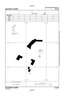
ADC chart of CLH7
 Satellite view of CLH7
Satellite view of CLH7
Sorry, we have no imagery here.
Sorry, we have no imagery here.
Sorry, we have no imagery here.
Sorry, we have no imagery here.
Sorry, we have no imagery here.
Sorry, we have no imagery here.


CLH7 - Long Harbour River
Located in , Canada
ICAO - , IATA -
Data provided by AirmateGeneral information
Coordinates: N47°54'16" W54°55'13"
Elevation is 300 feet MSL.
Magnetic variation is -18.4° East View others Airports in Newfoundland and Labrador
Operational data
Special qualification required
Current time UTC: 21:56:36
Current local time:
Weather at : - ( 0 km )
METAR: KJXI 190015Z AUTO 36005KT 10SM SCT020 08/04 A3002 RMK AO2 T00780037
Communications frequencies: [VIEW]
Runways:
Airport contact information
Address: Canada
Satellite view of CLH7
Sorry, we have no imagery here.
Sorry, we have no imagery here.
Sorry, we have no imagery here.
Sorry, we have no imagery here.
Sorry, we have no imagery here.
Sorry, we have no imagery here.